
 English
 Español
 Deutsch
 日本語
日本語 Polska
 Français
 中國
中國 한국의
한국의 Українська
 Italiano
 Nederlands
 Türkçe
 Português
 Bahasa Indonesia
 Русский
 हिंदी
हिंदीTopoExport Frankfurt-am-Main dxf dwg Gratis 3D Model

$0.00

- Mogelijke formaten:
ma: ma 2.80 MB
- Geanimeerd:No
- Texturen:No
- Gemanipuleerd:No
- Materialen:
- Low-poly:No
- Collectie:No
- UVW-toewijzing:No
- Plugins Gebruikt:No
- Afdruk Gereed:No
- 3D-scan:No
- Volwassen:No
- PBR:No
- AI-training:No
- Geometrie:Polygonal
- Onverpakte UV's:Unknown
- Aantal keer bekeken:402
- Datum: 2025-03-13
- Item ID:562053
- Rating:
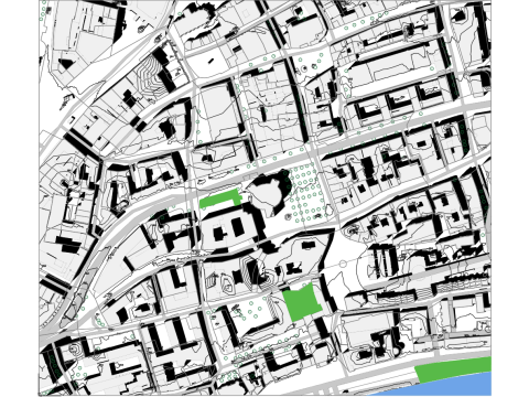
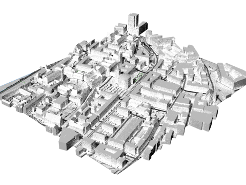
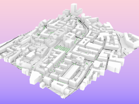
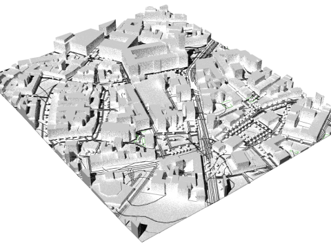
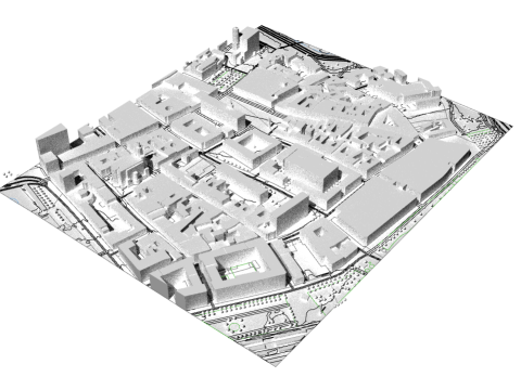
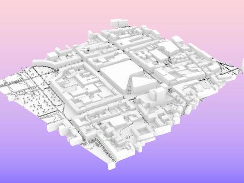
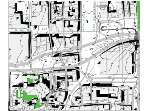
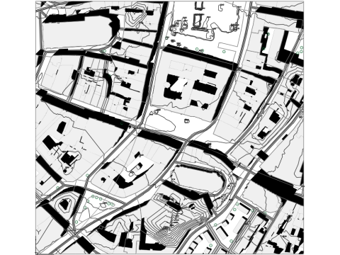
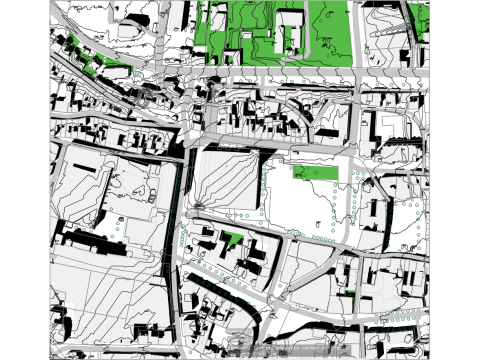
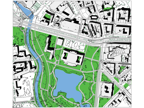
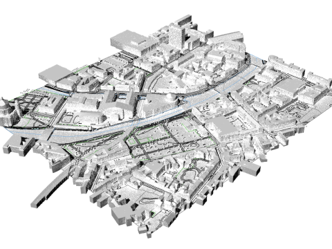
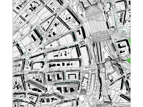
Frankfurt am Main.dwg topoexport.com Geodata description:
Frankfurt am Main Alkis: Buildings (2D) and parcels from Alkis, licensed under dl-de/by-2.0. (Data available at topoexport.com)
3D building model: Buildings in the LOD2 standard from the 3D building model LOD2, licensed under dl-de/by-2.0. (Data available at topoexport.com)
Frankfurt am Main DLM: Roads, railway lines, waterways, and tree canopy cover from DLM, licensed under dl-de/by-2.0.
Frankfurt am Main DGM1: Terrain model (DTM, 1 m) from DGM1, licensed under dl-de/by-2.0. (Data available at topoexport.com)
Nearby cities:
Offenbach am Main.dwg
Hauptwache.dwg
Sachsenhausen.dwg
Meer formaten nodig?
Als u een ander formaat nodig heeft, open dan alstublieft een nieuwe Support Ticket en vraag om een ander formaat. Wij kunnen uw 3D modelen van vorm veranderen naar: .stl, .c4d, .obj, .fbx, .ma/.mb, .3ds, .3dm, .dxf/.dwg, .max. .blend, .skp, .glb. We converteren geen 3D-scènes en formaten zoals .step, .iges, .stp, .sldprt.!
Als u een ander formaat nodig heeft, open dan alstublieft een nieuwe Support Ticket en vraag om een ander formaat. Wij kunnen uw 3D modelen van vorm veranderen naar: .stl, .c4d, .obj, .fbx, .ma/.mb, .3ds, .3dm, .dxf/.dwg, .max. .blend, .skp, .glb. We converteren geen 3D-scènes en formaten zoals .step, .iges, .stp, .sldprt.!
Highly detailed geodata—perfect for urban planning or architectural projects in Frankfurt! Great that it’s fully accessible Visit this site and in multiple formats.