English
 Español
 Deutsch
 日本語
日本語 Polska
 Français
 中國
中國 한국의
한국의 Українська
 Italiano
 Nederlands
 Türkçe
 Português
 Bahasa Indonesia
 Русский
 हिंदी
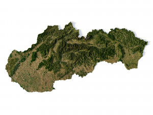
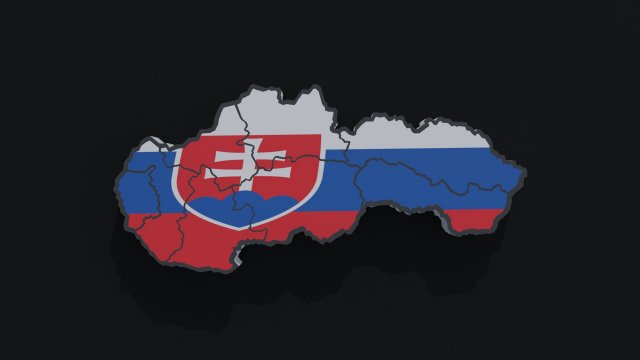
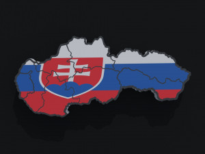
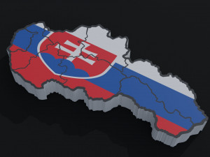
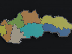
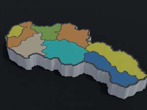
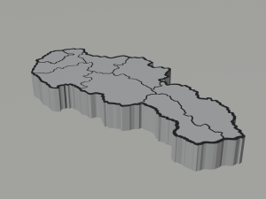
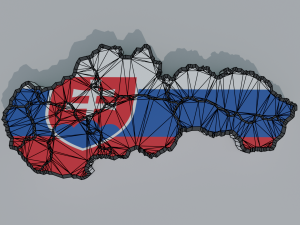
हिंदीPolitical Map of Slovakia 低ポリ 3Dモデル


- 利用可能フォーマット: obj: obj 109.51 kbpng: png 126.12 kbblend: blend 398.02 kb
レンダー: Cyclesfbx: fbx 128.79 kbglb: glb 216.59 kb
- 多角形:6512
- 頂点:4760
- アニメーション:No
- テクスチャー加工:
- 装飾:No
- 素材:
- 低ポリ:
- コレクション:
- UVW マッピング:No
- 使用中プラグイン:No
- 印刷 準備:No
- 3D スキャン:No
- 成人コンテンツ:No
- PBR:No
- ジオメトリ:Polygonal
- 展開済 UVs:Unknown
- ビュー:1690
- 日付: 2022-05-16
- アイテム ID:398404
- 評価:
This is 3d model of the map of Slovakia. Includes all the regions of Slovakia.(2 objects)
Models:
Slovakia map- 1
Slovakia map flag color- 1
Create in Blender 3d v 2.92.0
File formats:
Blender 3d v 3.3.1
OBJ; MTL
Fbx
Gltf
The preview images were rendered in Blender 3d (Cycles; 1024 Samples)
Materials: 9
Texture: 2048x2048
Vertices: 4760; Polygons: 6512 印刷 準備: いいえ
詳細を読むModels:
Slovakia map- 1
Slovakia map flag color- 1
Create in Blender 3d v 2.92.0
File formats:
Blender 3d v 3.3.1
OBJ; MTL
Fbx
Gltf
The preview images were rendered in Blender 3d (Cycles; 1024 Samples)
Materials: 9
Texture: 2048x2048
Vertices: 4760; Polygons: 6512 印刷 準備: いいえ
フォーマットが必要ですか?
異なるフォーマットが必要な場合、サポートチケットを開き、注文をしてください。3Dモデルをこれらに変換できます: .stl, .c4d, .obj, .fbx, .ma/.mb, .3ds, .3dm, .dxf/.dwg, .max. .blend, .skp, .glb. 3D シーンは変換しません .step、.iges、.stp、.sldprt などの形式。!
異なるフォーマットが必要な場合、サポートチケットを開き、注文をしてください。3Dモデルをこれらに変換できます: .stl, .c4d, .obj, .fbx, .ma/.mb, .3ds, .3dm, .dxf/.dwg, .max. .blend, .skp, .glb. 3D シーンは変換しません .step、.iges、.stp、.sldprt などの形式。!
ダウンロード Political Map of Slovakia 3Dモデル obj png blend fbx glb から Tykryk
slovakia political map bratislava country cartography geography atlas flag symbol europe eastern countries eu borders europa terrain exterior landscapeこのアイテムにコメントはありません。