English
 Español
 Deutsch
 日本語
日本語 Polska
 Français
 中國
中國 한국의
한국의 Українська
 Italiano
 Nederlands
 Türkçe
 Português
 Bahasa Indonesia
 Русский
 हिंदी
हिंदीNebraska Topographic Map STL Model 3Dプリントモデル


- 利用可能フォーマット: stl: stl 442.25 MB
- コレクション:No
- 幅(mm):389
- 高さ(mm):2.1
- 奥行(mm):178
- 印刷 準備:
- 3D スキャン:No
- 成人コンテンツ:No
- PBR:No
- AIトレーニング:No
- ビュー:1839
- 日付: 2022-06-17
- アイテム ID:402320
- 評価:
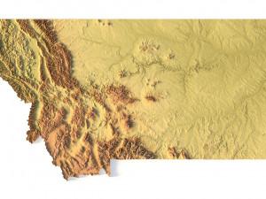
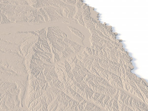
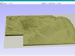
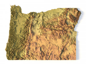
Create Detailed Nebraska Terrain Models with This High-Resolution 3D STL
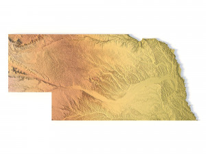
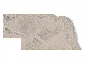
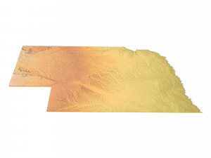
The Nebraska Topographic Map STL model provides a high-resolution depiction of the state’s distinctive topography and geographic features. This 3D model is ideal for crafting physical relief maps from materials like wood, metal, plastic, or concrete. Whether for landform visualization, educational projects, or professional GIS applications, this model offers accurate elevation data for precise terrain modeling. It’s perfect for use with 3D printers, CNC machines, and laser engravers.
- File size: 850 MB / 555 MB
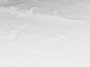
- Model size: 389.36 mm x 177.84 mm x 2.104 mm
- Resolution: 0.08 mm
- Projection: Mercator
- Scaling factor: X – 0.0000004; Y – 0.0000004; Z – 0.0000012
- Number of polygons: 17 842 724
- Number of vertices: 8 929 262
- Polygonal mesh: Triangles only
- Base: Open / Closed
Features of the Nebraska Topographic STL Model
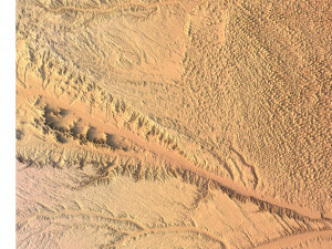
Precise elevation data capturing Nebraska’s plains, sandhills, and river valleys.
Compatible with FDM/SLA 3D printers for high-quality terrain models.
Designed for CNC machining to create relief maps from wood or metal.
Supports high-precision laser engraving for metal surface detailing.
異なるフォーマットが必要な場合、サポートチケットを開き、注文をしてください。3Dモデルをこれらに変換できます: .stl, .c4d, .obj, .fbx, .ma/.mb, .3ds, .3dm, .dxf/.dwg, .max. .blend, .skp, .glb. 3D シーンは変換しません .step、.iges、.stp、.sldprt などの形式。!
ダウンロード Nebraska Topographic Map STL Model 3Dプリントモデル stl から sychev23021983
usa state country america map nebraska topographic topo landscape terrain relief geography mountain stl cnc関連するアイテム から Nebraska Topographic Map STL Model