
 English
 Español
 Deutsch
 日本語
日本語 Polska
 Français
 中國
中國 한국의
한국의 Українська
 Italiano
 Nederlands
 Türkçe
 Português
 Bahasa Indonesia
 Русский
 हिंदी
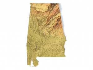
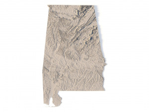
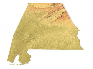
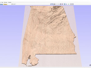
हिंदीAlabama Topographic Map STL Model Model Cetak 3D


- Format yang tersedia: stl: stl 445.44 MB
- Koleksi:No
- Lebar dalam milimeter:159
- Tinggi dalam milimeter:1
- Kedalaman dalam milimeter:251
- Siap Cetak:No
- Pindai 3D:No
- Konten Dewasa:No
- PBR:No
- AI Pelatihan:No
- Tampilan:1960
- Tanggal: 2022-06-11
- ID Barang:401623
- Peringkat:
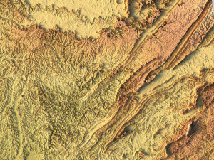
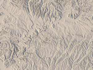
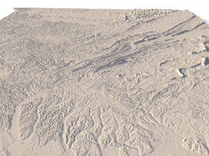
Create Detailed Topography with this 3D STL Model
This Alabama topographic map STL model is perfect for those who need a high-precision terrain model. Whether you’re a professional in geospatial analysis, an enthusiast in 3D printing, or someone interested in landscape representation, this model will help bring the natural features of Alabama to life.
• Format: STL
• Files size: 801 MB/419 MB
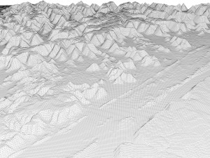
• Polygons: 16 815 236
• Vertices: 8 419 743
• Geometry: Polygonal Tris only
• Model size: 159.48 mm x 251.88 mm x 0.991 mm
• Projection: Mercator
• Scaling factor X:Y:Z: 1:1:3
• Base: Open/Closed
Key Features of the Alabama Topographic Map STL
• Supports FDM/SLA 3D printers for plastic or photopolymer models.
• Compatible with CNC machines for wood or metal terrain models.
• Precise 3D laser engraving for metal surface detailing.
Jika Anda membutuhkan format yang berbeda, silakan buka Tiket Dukungan baru dan minta itu. Kita dapat mengonversi model 3D menjadi: .stl, .c4d, .obj, .fbx, .ma/.mb, .3ds, .3dm, .dxf/.dwg, .max. .blend, .skp, .glb. Kami tidak mengonversi adegan 3d dan format seperti .step, .iges, .stp, .sldprt.!


