
 English
 Español
 Deutsch
 日本語
日本語 Polska
 Français
 中國
中國 한국의
한국의 Українська
 Italiano
 Nederlands
 Türkçe
 Português
 Bahasa Indonesia
 Русский
 हिंदी
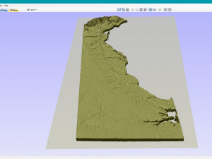
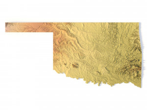
हिंदीTopographic Map Delaware STL Model 3D 打印模型

- 可用的格式: stl: stl 121.11 MB
- 集合:No
- 以毫米为单位的宽度:33
- 以毫米为单位的高度:0.28
- 以毫米为单位的深度:79
- 打印准备:No
- 3D扫描:No
- 成人内容:No
- PBR:No
- 人工智能培训:No
- 日期:1705
- 日期: 2022-06-17
- 项目 ID:402261
- 评分:
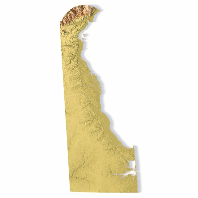
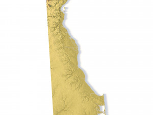
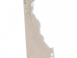
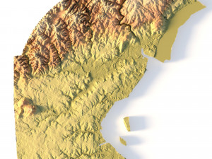
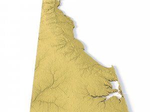
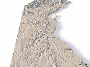
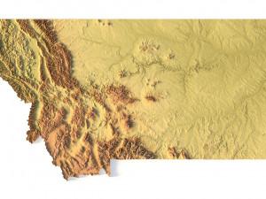
Create Precise Delaware Terrain Models with This 3D STL File
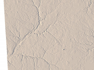
The Topographic Map Delaware STL model offers a highly detailed relief map of Delaware’s landscape. Perfect for creating physical models from wood, metal, plastic, or concrete, this 3D model is ideal for terrain visualization and landform representation. Whether for educational projects, geospatial analysis, or personal use, this model provides accurate elevation data of Delaware’s terrain.
- File size: 144 MB
- Model size: 32.91 mm x 79.38 mm x 0.284 mm
- Projection: Mercator
- Scaling factor: X — 1; Y — 1; Z — 3
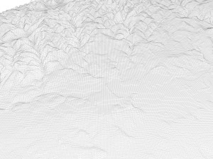
- Polygons: 3 039 422
- Vertices: 1 528 786
- Geometry: Polygonal Tris only
- Base: Closed
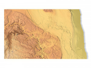
Features of the Delaware Topographic STL Model
Compatible with FDM/SLA 3D printers to create terrain models in plastic or photopolymer.
Designed for CNC machines for creating wood or metal models.
Supports high-precision laser engraving for metal surface relief maps.
如果你需要一个不同的格式,请打开一个新的支持票和为此请求。我们可以转换到 3D 模型: .stl, .c4d, .obj, .fbx, .ma/.mb, .3ds, .3dm, .dxf/.dwg, .max. .blend, .skp, .glb. 我们不转换 3d 场景 以及 .step、.iges、.stp、.sldprt 等格式。!


