
 English
 Español
 Deutsch
 日本語
日本語 Polska
 Français
 中國
中國 한국의
한국의 Українська
 Italiano
 Nederlands
 Türkçe
 Português
 Bahasa Indonesia
 Русский
 हिंदी
हिंदी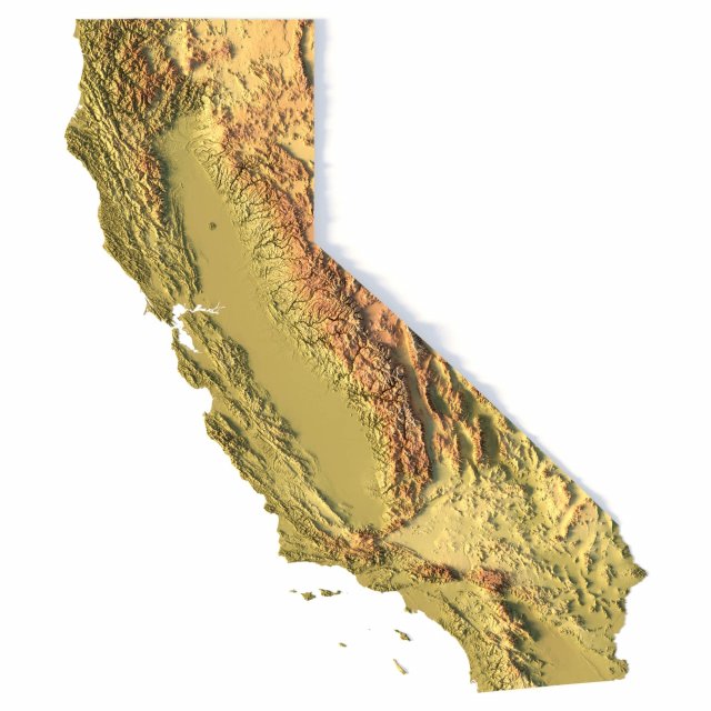


- 可用的格式: stl: stl 546.53 MB
- 集合:No
- 以毫米为单位的宽度:457
- 以毫米为单位的高度:5.4
- 以毫米为单位的深度:529
- 打印准备:No
- 3D扫描:No
- 成人内容:No
- PBR:No
- 人工智能培训:No
- 日期:2076
- 日期: 2022-06-17
- 项目 ID:402257
- 评分:
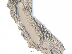
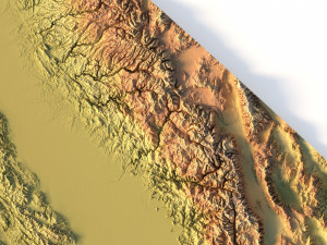
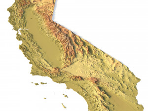
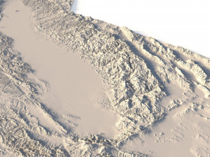
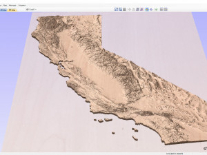
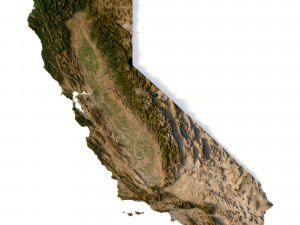
Create Detailed California Terrain Models with This 3D STL File
The Topographic California Map STL model provides a high-precision 3D terrain representation of the state. Whether you’re crafting topographic maps for landform visualization or working on professional geographic representation projects, this model captures the intricate elevation map details of California’s mountain ranges, valleys, and coastal features. Ideal for both hobbyists and professionals using 3D printers, CNC machines, and laser engravers.
- Files size: 1GB / 493 MB
- Model size: 114.35 mm x 132.2 mm x 1.341 mm
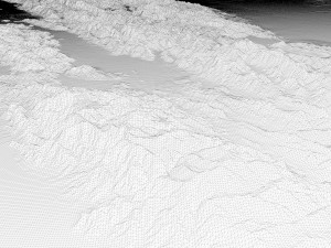
- Polygons: 14 394 280
- Vertices: 7 210 433
- Geometry: Polygonal Tris only
- Projection: Mercator
- Scaling factor: X - 0,0000001; Y - 0,0000001; Z - 0,0000003
- Base: Open/Closed
Key Features of the Topographic California Map STL Model
Compatible with FDM/SLA 3D printing for creating physical models of the terrain.
Designed for CNC machining on wood and metal materials.
Supports high-precision laser engraving for fine surface detailing on metals.
如果你需要一个不同的格式,请打开一个新的支持票和为此请求。我们可以转换到 3D 模型: .stl, .c4d, .obj, .fbx, .ma/.mb, .3ds, .3dm, .dxf/.dwg, .max. .blend, .skp, .glb. 我们不转换 3d 场景 以及 .step、.iges、.stp、.sldprt 等格式。!


