
 English
 Español
 Deutsch
 日本語
日本語 Polska
 Français
 中國
中國 한국의
한국의 Українська
 Italiano
 Nederlands
 Türkçe
 Português
 Bahasa Indonesia
 Русский
 हिंदी
हिंदी

- 可用的格式: stl: stl 352.19 MB
- 集合:No
- 以毫米为单位的宽度:332
- 以毫米为单位的高度:1.6
- 以毫米为单位的深度:170
- 打印准备:
- 3D扫描:No
- 成人内容:No
- PBR:No
- 人工智能培训:No
- 日期:1701
- 日期: 2022-06-17
- 项目 ID:402304
- 评分:
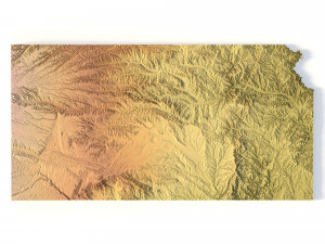
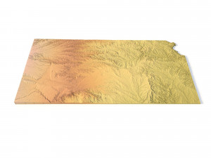
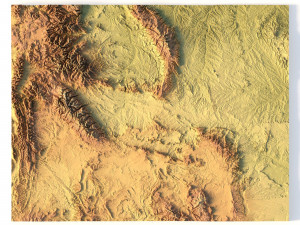
Create Detailed Kansas Terrain Models with This High-Resolution 3D STL
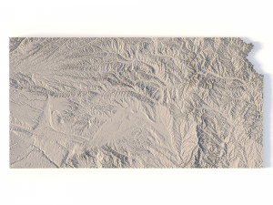
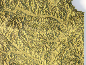
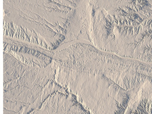
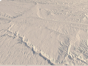
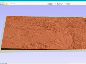
The Kansas Topographic Map STL model offers a high-resolution depiction of the state’s topography and its unique geographic features. This 3D model is ideal for creating physical relief maps from materials such as wood, metal, plastic, or concrete. Whether you’re working on landform visualization, educational projects, or professional GIS tasks, this model provides accurate elevation data for detailed terrain modeling. Suitable for 3D printing, CNC machining, and laser engraving applications.
- File size: 529 MB / 540 MB
- Model size: 332.1 mm x 170.5 mm x 1.595 mm
- Resolution: 0,1 mm
- Projection: Mercator
- Scaling factor: X — 1; Y — 1; Z — 3
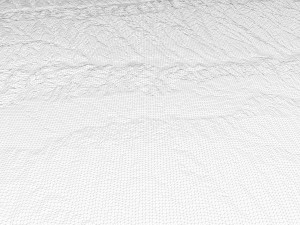
- Polygons: 11 114 706
- Vertices: 5 562 650
- Geometry: Polygonal Tris only
- Base: Open / Closed
Features of the Kansas Topographic STL Model
Precise elevation data capturing Kansas’ flat plains and subtle landforms.
Compatible with FDM/SLA 3D printers for creating high-quality terrain models.
Designed for CNC machining to craft relief maps from wood or metal.
Supports high-precision laser engraving on metal surfaces.
如果你需要一个不同的格式,请打开一个新的支持票和为此请求。我们可以转换到 3D 模型: .stl, .c4d, .obj, .fbx, .ma/.mb, .3ds, .3dm, .dxf/.dwg, .max. .blend, .skp, .glb. 我们不转换 3d 场景 以及 .step、.iges、.stp、.sldprt 等格式。!


